The Alan Turing Institute: The Alan Turing Institute, headquartered in the British Library, London, was created as the national institute for data science in 2015. In 2017, as a result of a government recommendation, it added artificial intelligence to its remit. The Institute is named in honor of Alan Turing (23 June 1912 – 7 June 1954), whose pioneering work in theoretical and applied mathematics, engineering and computing are considered to be the key disciplines comprising the fields of data science and artificial intelligence.
ESRI UK: ESRI pioneers problem-solving using GIS. It has been the global market leader in GIS, helping customers get results since 1969. It was founded to help solve some of the world’s most difficult problems by supporting its users’ important work with a commitment to science, sustainability, community, education, research, and positive change. It builds ArcGIS, providing Esri users with a scientific-based approach to solving problems in real time. ESRI believes location intelligence unlocks data’s potential in every organization and supports organizations everywhere with the most powerful mapping and spatial analytics technology available.
Ordnance Survey: Ordnance Survey (OS) is Great Britain’s national mapping agency. It carries out the official surveying of GB, providing the most accurate and up-to-date geographic data, relied on by government, business, and individuals. OS uses its valuable data and expertise, built on over 225 years of experience, to contribute to the future success of Britain and other nations. It continually refines its data to present an accurate digital view, delivering to business and the public sector. OS facilitates important decisions that will go onto enhance the quality of life of future generations. OS has created a range of consistent and up-to-date data products of Great Britain, including its most detailed digital map OS MasterMap with its Topography Layer; high-resolution digital imagery; 3D models of the terrain and elevation features; road and water networks. OS is also exploring new ways to capture even more detailed features in the landscape, particularly at street level, such as lamp posts and bus stops, to support smarter communities, which includes vehicle-based surveying on the ground, using unmanned aerial vehicles, and high-altitude pseudo satellites. OS helps keep transport flowing, ensure online shopping gets delivered to the door, and underpin every property sale in Great Britain. In communities across Great Britain, OS’ work enables a safe, healthy and prosperous society. Its data is used by more than 5,000 organisations working for the public good in areas such as housing, the natural environment, connected transport and national security. Its data is trusted to support policy and the delivery of public services at every level of government. OS is working with countries all over the world and uses its expertise and capability to support sustainable development and deliver efficient public services – improving quality of life for millions of people. It offers advisory services, working with organisations, governments and other national mapping agencies to improve policy making and increase geospatial capabilities.
The Urban Big Data Centre: The Urban Big Data Centre (UBDC) is a research centre and national data service based at the University of Glasgow. We promote the use of big data and innovative research methods to improve social, economic and environmental well-being in cities. UBDC has been jointly funded by the Economic and Social Research Council (ESRC), which is part of UK Research and Innovation (UKRI), and the University of Glasgow since 2014.
Open Source Geospatial Foundation: The Open Source Geospatial Foundation (OSGeo) is a not-for-profit organization whose mission is to foster global adoption of open geospatial technology by being an inclusive software foundation devoted to an open philosophy and participatory community driven development. The foundation provides financial, organizational and legal support to the broader open source geospatial community. It also serves as an independent legal entity to which community members can contribute code, funding and other resources, secure in the knowledge that their contributions will be maintained for public benefit. OSGeo also serves as an outreach and advocacy organization for the open source geospatial community, and provides a common forum and shared infrastructure for improving cross-project collaboration.
British Cartographic Society: Founded in 1963, the British Cartographic Society (BCS) offers a unique forum for exchanging ideas and sharing knowledge on all aspects of maps, mapmaking and geovisualisation. The organisation’s membership includes national mapping agencies, cartographers, GIS specialists, publishers, academics, researchers, map curators and those with a love of maps.
Consumer Data Research Centre: The Consumer Data Research Centre (CDRC) was established in 2014 with funding from the UK Economic and Social Research Council (ESRC) to lead academic engagement between industry and the social sciences, and utilise consumer data for academic research purposes. CDRC provides unique insight into a diverse range of societal and economic challenges, in collaboration with a wide range of consumer data providers.
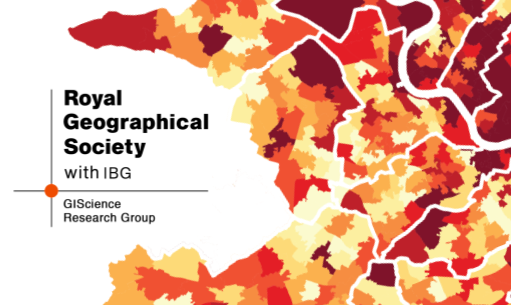
The GIScience Research Group at the Royal Geographical Society with IBG : The GIScience Research Group (GIScRG) at the Royal Geographical Society with IBG is a group of academics and practitioners interested in promoting GIScience, Geographic Data Science and GI Technology in geographical research, teaching and the workplace. GIScRG also supports and promotes e-science and the application of novel computing and spatial analysis paradigms to geographical systems.